Stories
Around the bivouac fire
Back
06 April 2017
Endgame
Heat, wind and rain showers in the morning validated the forecast. The decision is easy to take now, as I won't be able to safely reach Pokhara via the air. The worsening weather conditions would make this last leg of the trip highly uncomfortable, and even dangerous in the Baglung and Kusma valleys, two long deep valleys that feed the Annapurna range.
I'm writing this in the bus that will drive me to Pokhara. Better safe than sorry. The long trip also validates my decision, as we slowly crawl our way through winding valleys where the wind bends the trees, dominated by dark clouds overhead. The lack of good landing options matches the lack of potential take-offs. The only way out would be by the top.
This last part of the trip illustrates the difficulty of the game.
On my last big flight, from Jumla to here, I wanted to stay South of Dhaulagiri range and Dhorpatan reserve. But to cross the area you need to be up north, in the big mountains. Too much trees and wind here, and no good support to soar your way out. The issue is that up North it's very high mountains and passes, so you need exceptional days and low wind, which won't happen before a week or so. But I didn't know that when I was deep into remote valleys, without access to weather forecasts. That's the game! You never really know where you're going to end up in a vol-biv adventure, and that's why we do it :-)
05 April 2017
Weather
The weather decidedly wants to make my trip harder!
After three good days, I'm now in the lower parts, in the stability. Low cloud base, strong valley wind, a few weak thermals but not enough to progress. Today I made 4 km in a one hour headwind battle... Oh and did I mention rain showers?
I have two dangerous valleys to cross still, where I need high cloudbase and ideally low wind to cross safely. Right now it's the opposite, I can't fly. And it looks worse for the following days!
I don't have time to wait for better weather, and honestly I'm exhausted from the flight of yesterday, which in the first 3 hours took a lot more energy than anticipated. I'll see what I do tomorrow, now I need to rest a bit!
04 April 2017
Carah
These are my new friends, the Nepali word for birds, who allowed me to exit the valley system I was stuck in.
After the record day on the 2nd and the cloud labyrinth yesterday, I got lost and took a wrong path and ended up in a very deep, very far valley where I basically don't understand anything. There is a complex pattern of mountains breathing and valley exchanges, it's crazy. And the way is blocked to the east by the Dhaulagiri, so I have to head South.
Early launch at 11am in front of cheering children. Extraction is easy, I head back West to go around a big mountain that blocks the way. Then it's a 3 hours long SIV clinic, fighting the Bheri Kola valley wind. It's a real nightmare, the worst flying I've ever done. I follow some vultures who climb where there shouldn't be any lift. Sometimes at full bar facing a cliff I'm at 10km/h, thankfully in the right direction. After more than 40km in a headwind, always in the lee of something, I manage to exit this valley and head South East, towards Pokhara.
I had to go south for several good reasons. One is that the Kagmara range leads to Dhaulagiri, both very high ranges with very Big Mountains where you need record days and stratospheric cloudbase to cross. The other small problem is the Dhorpatan hunting reserve, home of rhinoceroses and tigers and other nice pets. You don't want to land there.
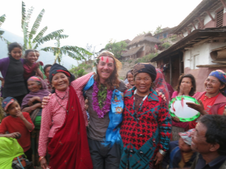
I land on a ridge close to Dhorpatan, which I wanted to visit but I missed the valley (again). As usual now, I'm the first ever paraglider pilot to come here, and the first foreigner since more than 50 years. The welcome is very nice, with a group of women singing and dancing for me, nice scarf and fresh flowers necklace, the whole show!
I'm invited to stay at the house of the Wise Man of the village. It's a bit special today as it is Chaitra Dashain, a Hindu holiday that you celebrate with your extended family. So we spend the evening between men, drinking Roksi, eating nice mutton and Dahl baht, and talking about the village life, flying, etc. Then the family leaves me for the second part of the evening to celebrate the holiday.
I landed here because I think I can take off from a steep slope above the village. After that it's a straight line to Pokhara, riding the South part of Dhaulagiri. I'm exhausted, time to get some rest!
04 April 2017
Badal
This means cloud in Nepali.
April 3. The face I'm on will take the valley wind, so I sleep a bit more and forget the hike. Many villagers are here to see me taking off, but the wind is strong and gusty, I need 3 tries to manage it. Not a good start, I'm in the air around noon.
The flight is globally unpleasant. Clouds everywhere blocking the way, I have to zigzag to stay in the blue while keeping an eye on them. The wind is very present too, and globally I don't understand much of the valley systems around here. This diverts me from the path, I'm much to high to the North, I need to correct that and go Southeast, to stay South of Dhorpatan and the very high Dhaulagiri range, but everything is blocked very early.
I don't want to end up in the middle of a dead end, and some clouds start to become a bit too dark, time to land. I fly back to a big village on a South ridge, but by the time I'm trying to land the valley wind reversed and I battle for 15 or 20 minutes, doing huge wing overs and 360s in gusty wind and thermals, to finally land safely. The whole village is ecstatic, they think I put on a show just for them, when in fact I'm still shaking and pumped up from the battle.
I think more than 200 persons are here, I'm trying to calm down while packing before the rain, but they only want to talk to me. Hey! I'm the first paraglider pilot to come here, of course they're curious! So I talk to one school teacher, I need 15 minutes to pack before the storm, then I'm yours.
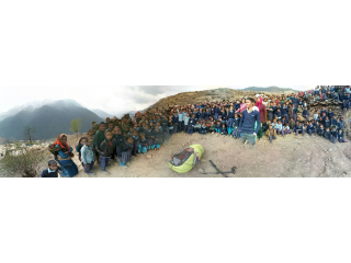
170 children are lined in the schoolyard while I describe what I'm doing, tell my journey from Dharamsala to here while pointing on my map, explain how I fly. Then a small girl sings a Nepali song to welcome me while all the others clap, before school dismissal. It's been a strange day for them as well!
I'm invited to stay at Bima's house, she's teaching Nepali. We have a very nice end of the day. Globalization exists here as well, the whole family watches WrestleMania while preparing the dhal baht! Crazy.
Tomorrow I need to go due South for 50km, towards Musikot, because the path is blocked to the east now. I'm in the wrong valley system, I need to find a way out. The is a low pass (3800m) that I should be able to cross, then follow the Bheri kola valley. Easier said than done, but we'll see!
04 April 2017
Record day
April 2. Some kids and adults are gathered around my tent by 6:30 in the morning, I guess they know it's going to be a record flying day and don't want me to lose time!
It can be difficult to cook breakfast, gather everything and clean the camp when 15 people look at everything you do from very close. Several times I have to explain I need space, but it's useless. Oh well. By 9 I'm more or less ready, still didn't manage to get 5 minutes to find a bathroom bush! They told me I'm the first foreigner around here, and I'm doing weird things :-)
Finally when I start the hike they don't follow me, I guess they don't want to see me flying then! At first it's more climbing than hiking in the small wheat paddies, but it gets better. 2 hours later I'm at 2100m, at the top of a huge grass slope perfectly oriented. The Big Mountains to the North have been manufacturing cumulus since 9:30, the sky is blue, not a cirrus to spoil the day.
I take off at noon, my ridge is once again not generating cumulus, I'm cautious and track the birds. When I see a vulture circle above me I take off, and manage to soar my way up to a bigger mountain, then it's basically easy cloud flying. I stay at the edge of a big cloud, always close to the blue, following a cumulus street nicely laid before me. When it starts raining behind me I go one ridge more to the South, towards the blue sky, still cloud surfing. This is exhilarating!
My original waypoints were much more to the South, so I've put the Pokhara landing zone as goal. At launch the distance was 361km. It's so good to see this go down like clockwork, reaching down to almost 200 when I land!
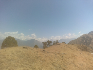
At 6pm I land very high, 3300m, on a Southwest ridge close to Jumla. I think I can hike up and reach a Southeast ridge in the morning, and since I'm quite high I can launch earlier! The night might be cold but after Dharamsala I'm ready ;-)
I'm very low on water, so I ration myself and keep half a litre for the hike tomorrow. On the map there is a stream somewhere close, the goal is to find it in the morning and then fly. But as I'm writing this in my tent, the door open to see the stars, 4 guys from a nearby village arrive and say hi. We discuss a bit, then I ask them about water. After some thinking they bring me to a damp part of the ridge, 15 minutes from my camp. There, a tiny tiny muddy stream can be heard. We build a makeshift fountain of mud, high enough so that I can put a coke bottle under it and fill it. Then the life-saving water filter comes into play, and in half an hour I have 3 litres of clean water!
01 April 2017
Relativity
Time and space are relative, even more so in Nepal.
This morning I took a shared jeep to go to a small town at the foot of a nice mountain that I think will work well. When asked, the driver says we'll go in 30 minutes, but as he's waiting for the Jeep to be full, hours pass and we're still waiting. We start to leave around noon, for what he says is an hour drive. Obviously we arrive two hours later, and with the massive hike ahead of me it means I won't be able to fly and progress today.
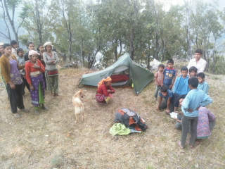
The hike is pleasant enough, but as the big clouds start to darken I start to look for a place to put my tent, not too close from the small houses that dot the mountain. As soon as I'm done with the tent I'm surrounded, again it's the first time that a foreigner comes here so I'm the local attraction of the day.
After a lengthy discussion I manage to make myself understood, and they leave me alone when the night falls, I barely have time to cook, eat and retreat in my tent before the thunderstorm breaks. Nice light and sound show tonight!
31 March 2017
Early wake up this morning, the kids are banging on my door, they want to see the tall stranger.
After that it's a staring game, as they're too shy to talk :-D
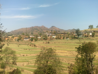
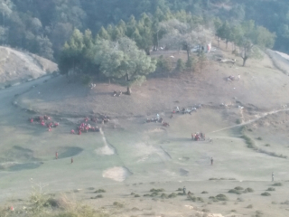
Long hike again, to the mountain on the North East, which was a thermal factory yesterday. This photo shows part of the nice small village that welcomed me. Unfortunately the weather decided that I won't progress yet, as wind and thermals were nowhere to be seen today, just a thick inversion layer and unbearable heat. I wait on the slope until 2pm and then decide to walk to the North, where the Big Mountains are called with nice clouds.
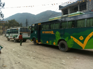
On the way a bus stops and I hop on it, it's going closer to the mountains. Nice evening in Gokuleshwor, hopefully I'll get some rest despite the heat. Tomorrow I'll take a shared jeep and hike to a nice South face which should take the valley wind, maybe I'll get to fly!
31 March 2017
Urdnu
March 30.
This means "to fly" in Nepali, something that I seem to have forgotten how to do lately.
I spent an almost sleepless night in a bus from Mahendranagar to Baitadi, opposite the border from Pithoragargh. There is a small ridge that I think I can take off from, but I ended up 20km from there. Turns out that names on Google maps don't translate directly to town names in real life, and that the name I saw closest to the ridge is a district name, so I ended up at the bus terminal of this district. Oh well.
An hour later after surreal discussions with locals, pointing to the map "I'm here and I want to go there" - "but there, it's here!", I'm in a bus to Dehimandu. There I manage to have an hour alone, napping in a field, but this is short lived and I soon have most of the village with me at takeoff! They help me with cleaning a bit, removing cactus and other nice traps. Last picture, the ridge takes the West wind and the sky is lit, with a bit of luck I'll climb and top out quickly. But I can't find any lift, and land almost immediately in the next village. Once again I managed to find the only ridge without thermals... This trip is transforming into bivvy-sledding.
As soon as I landed I'm surrounded. My frustration of not flying is quickly erased by the hilarity and interest of locals, and we talk a lot.
It's already late when I finish to pack, I'm invited to stay at Shankar's house in the village. He's in the army, stationed in Lumbini, but he's constantly on the phone to know how things are going along here :-)
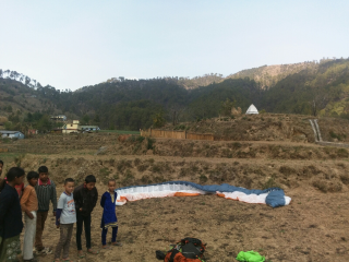
Around 5pm three is a nice valley wind, I saw a small hill with big flat empty space at the bottom, so I did several demonstrations flights (more like hops) in front of what seems to be the whole village, kids and adults are delighted. I learn that I'm the first foreigner that they meet, and they never saw paragliding either, so they're excited. The whole afternoon and evening I'm surrounded, no time or space for myself until bedtime. I'm exhausted.
In the morning I'll hike up another ridge above the village, to the North East. This one was generating nice cumulus today, hopefully it will work.
29 March 2017
In transit
With the heat wave and stability preventing any progress, I had to make the hard decision to continue by jeep and bus. I can't fly or walk that much distance, and I can't lose a week or more doing nothing either. So I spent 12 hours yesterday going from Bageshwar to Banbasa, at the border.
My friends of 3TAdventure found a jeep going to Haldwani, a long drive punctuated by long stops due to road work. The lowlands are very hilly, the valley offer few landing options, and I didn't see a single cumulus or thermaling bird. This validated my decision. In Haldwani I literally jumped in a bus that was going to Banbasa, but an issue with the gearbox meant that we only could reach 15km/h or so, so we had to change for another one, infested with mosquitoes. Arrived in Banbasa, an undescript town on the border, at 10pm just in time to find a hotel room and something to eat.
Border crossing is a simple but long process, stretched on the 20km between Banbasa, India and Mahendranagar, Nepal. You can't just walk, you need transportation. I met Raj, a nice Nepali that took me to Mahendranagar on his bike, and helped me get a ticket for the remaining of my bus trip. He's originally from Baitadi, the next stop of my journey.
Tomorrow early morning I'll be there, the area should be a nice starting point for the Nepal leg of the trip. It's just across the border from Pitoragargh, India, and it's high enough to hopefully avoid the stability.
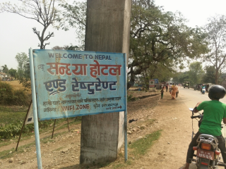
Welcome to Nepal!
27 March 2017
Barometric Swamp
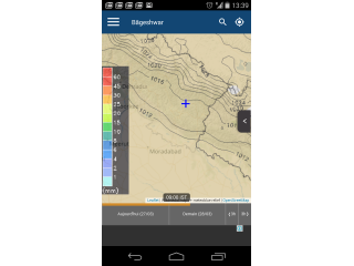
What I feared these last days, with ever increasing temperature, finally happened. I won't escape through the air.
A barometric swamp is an ultra stable air mass, and with the very high temperatures this means end of the game, I won't fly the low terrain to the South, where I need high instability. The heat wave and stable conditions will last a week or so.
This morning I overslept. When I exit my small fresh room the heat is already present, hitting you in the face. I found a takeoff; the hike which should have taken 1 hour takes 2, and most of my water. The slope is nice, takes the valley wind, but only 150m or so from the valley floor. And it's stable. Not a cloud to be seen. Birds are flying their wings. The valley wind should be more powerful. It arrived. The dreaded barometric swamp is here, with an heat wave as companion. I don't even bother to fly, I know the issue. Even if by chance I manage to escape this ridge, the next won't be as generous and there is zero landing option for a while. Better safe than sorry, I go back to the city to visit.
I met a new "dost" (friend), Nitesh, who's working hard with 2 of his friends to bootstrap their adventure company. They offer tours of the glaciers and summits in the Eastern part of Nanda Devi mountain range. I've also meet one of their friends, a retired army paraglider pilot living in the valley. I'm happy to learn my chosen site for this morning's takeoff is also his, it means I'm not so bad at finding them. He wants to develop the activity around here, it's nice but the area is not easy to work with.
Nitesh invites me for dinner in his family house, I spent a very nice evening, discussing mountains and adventures and culture around homemade dinner and chai.
Tomorrow I meet my new friends for breakfast, then I'll take a bus to the South, towers
Towards Banbasa the border crossing to Nepal. I've lost a lot of time already, I can't wait another week for conditions to improve in the lows. I can't walk either, I'm far too slow, and with the additional water I'll need to carry it's even worse. Once in Nepal I'll go North, towards the border close to Pitoragargh, and resume my journey through the air, hopefully with better weather.
Namaskhar India!
26 March 2017
Dead end
It's official, I won't get out of here by the air. This place is an aerological clusterfuck, a paragliding dead end, a motivation sinkhole.
The day is perfect. Big cumulus streets, strong valley wind, low West trade wind. The takeoff takes the valley wind perfectly. It can work. It should work.
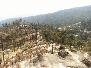
But the ridge I'm on, the only place where I can takeoff in this whole valley system, is the only one which does not generate cumulus. The valley wind doesn't translate to lift. As soon as I'm airborne, I scratch around but nothing. I bail out and land in the only safe landing zone around, just below the town. On the picture we can see the take off 300m above.
I'm getting sick of this place. I need to progress. I know there has been some paragliding competitions in Pitoragargh, to the east. I need to move.
25 March 2017
Stuck
Today I hiked 4 hours back to the town I was in yesterday. The day started as usual, with a nice hike to the only potential take off I found in this hilly area. 12:30 and still no sign of thermal activity, only blue sky and some sparse cirrus. But I think the valley wind is enough to take off and maintain myself in the air, so I go.
I manage to scratch and climb above take off, but not much. The ridges going to my next waypoint are all slowly descending towards the Baijinath valley where I landed 2 days ago, covered with trees, I know they will not work.
There is a bigger, higher ridge on the North, if something will work it's this one. So I soar my way towards this ridge, then it's a leap of faith. Unfortunately the lift I was hoping to find is in fact a big downdraft, and I'm too low to go back to the previous ridge, so I commit myself and push down a small high valley to find something. Lift, landing, anything.
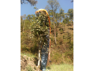
I land safely in a small field, the only landing option around here. I'm safe on the ground, but the wing decided that a nearby tree needed a new decoration. Oh well, here goes my day!
At least I learned some things about this place: there are trees everywhere, it's nearly impossible to land or take off. Aerologically this place is a mess, I won't be able to soar my way out of here, it just won't work, the topography is just not good. I need thermals, higher ceiling. Even then, I don't know how to get out of here, and it looks the same all along my route to the border crossing. So close, yet so far!
After landing and sorting my wing out, I had to make a decision. I could try to progress, hike on the ridge towards the east, towards Bageshwar, knowing that there is no possibility to take off. It's 25km away, in straight line, at least a full day of hiking, maybe more. I don't have much water and didn't see obvious sources while exploring yesterday. Not good. Or I can hike back to the one takeoff that I know is safe and should work tomorrow. That took me 4 hours, and all of my water, to hike back there. Good decision, tomorrow I'll be prepared. Tomorrow I'll get unstuck.
24 March 2017
Strategy
There are a lot of things to manage in a vol-bivouac expedition. Route, walk or fly, food and water, exhaustion, motivation. It's always a trade off game. But the most difficult part of the adventure is not what you think. Let's explore together some random thoughts that came to mind when preparing my trip through the Himalaya.
To cover the distance safely, you need gear, a lot more than you would hope at first. Wing & co, repair kit for the gear and for the guy, clothes, cleaning & sleeping & cooking, food, water, camera, batteries, solar charger, maps, phones, etc. This amounts to a lot of weight, but it's manageable. You'll fly most of the way, because you have time and can wait until the bad weather conditions change. And the first few days will be hard, but you'll get used to the weight when trekking. Use poles! The big issue can come from your wing loading, too high and it will become snappy and bad in small conditions. Be careful, high wing load also converts to higher speed, in the air and on the ground! Be prepared for sporty landings. Be current on your wing. SIV and a bit of acro background are a good idea.
Next issue is energy. To be able to sustain a consequent effort during almost a month, in the wild, you'll need plenty of food, but that means weight, and means energy consumption when you walk. I made a compromise, choosing to take a week's worth, and trying to stay close to villages to have local meals most of the time. Also to cook you need fuel, and this is heavy, and alcohol might not be available everywhere. But this trade off comes with another issue...
Routing. When poring over the maps during the preparation, you see big mountains, sure to generate nice flying conditions (think neverending cloud streets and big varios). But this means high altitude, deep valleys (and accompanying wind), and no village. This also means cold. Very cold. You'll be prepared for that, of course, as you hope to do some big air flying, but being cold during 1 hour in the air is quite different than being cold all of the time. A cold night means sleep deprivation, lots of energy consumed to stay alive, loss of focus and bad morale. So you choose a route a bit more to the South, where the terrain is dotted with villages, where you'll be able to make new friends trying to explain your trip. And a night at 2000m in March is manageable, as long as your gear is dry. But this southern route means complicated valley systems, less altitude, less instability, and cultivated land. Which brings us to THE main difficulty of a vol-biv adventure.
Taking off.
Landing can be complicated sometimes, but as you're an XC pilot you know how to manage. The additional difficulty is that as you land, hopefully after a long distance flight, you need to look for potential takeoffs everywhere, close to your landing zone. They need to be correctly oriented for the valley wind, in a valley you know nothing about. They need to be clear of lines, trees, barbed wire, etc. When possible, they're not in the lee or a rotor. They need to be reachable, not too far because you don't want to lose a day hiking there. Not too low because extraction is a gamble. They need to be not too flat, not too steep, although neither should be a problem. Practise ground handling. Lots. You won't have the perfect conditions nor the perfect carpetted takeoff that you have at home.
Of course you can prepare a bit, with countless hours on Google Earth. But it doesn't show the height of trees, lines, etc. And the playing field is big. Enormous. It's impossible to survey all 900km of the direct route, and even less so the infinitely many possibilities that you will encounter when flying there. It's not a bike trip where you can plan every day route and night bivouac, you need to adapt. And it's way more fun this way! Talk to local people. Keep your eyes open. Explore.
So here is the big picture: lots of gear, to survive in the wild safely. 1 week of food, just in case you're stranded in the wild wild West. A southern route, to avoid cold weather and demanding mountains, but more complicated and frustrating. But above all, explore, and look out for takeoffs!
23 March 2017
Big Air
I broke several personal records today! Gliding 5200m above sea level, flying 162km in the Himalaya, with a top speed of over 90km/h thanks to the Westerly trade wind in altitude.
Awesome flying, by the book. Climb, cloud base, follow the cloud streets, fly the sky!
The weather was nice to me today. I was anticipating a good day, and I wanted to be in shape, so I took a jeep for a 2 hours drive that positioned me closer to take off, still a one hour hike to some wheat paddies on a ridge just above the town I spent the previous day in.
The take off was fun, jumping down from paddy to paddy until with the wing over my head. The extraction was straightforward, then the fun began! And it was really a very good flight, I got to enjoy every moment of it.
I landed shortly before the 5th hour, hitting a wall of trade wind + valley wind trying to go south, over a complicated arrangement of ridges.
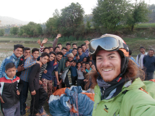
I chose to land in a big empty playing field at the bottom of the valley, because the cultures are planted almost everywhere. I got cheered by a lot of kids as I was doing wing overs to go down, I think they liked it as much as I did :-)
22 March 2017
Rest day
Today the forecast looked bad, strong wind, and the long hike and complicated flight took their toll, so I decided I need a rest day. Also I'm in a small lively town, so it's going to be interesting.
I got to taste the local specialties. But be careful, even when you explicitly ask "not spicy" you'll need a fire extinguisher. Also, there is no menu, everything is already cooked and waiting in big pans, and you have to eat with your right hand only, otherwise you get some strange looks :-) There is no cutlery, and the left hand is traditionally used to clean yourself in the bathroom, so it's always considered dirty. As a lefty it's hard to adjust :-D
I met a store owner, Surender, who lived in Algeria and wanted to talk, so I spent some time with him in his shop, watching the town life from inside. I think I helped his business too, lots of curious people wanted to see the tall Frenchie and came to buy something as an excuse.
Walking around I drew quite the crowd,I think they never see foreigners around here. Most adults don't speak English, although it's an official language of India, so I made a lot of friends with kids who learn English in school. They're always proud to display their fluency, and they told me about the small temple in their part of town, dedicated to Sarasvati devi, the Goddess of Knowledge. Quite the coincidence!
I also took time to study my next steps, with my very good friend Google Earth. In the morning I have another big hike, and I'll try to find a take off on a South West ridge across the river. Then I'll head due East, to reach higher mountains and hopefully find some much needed instability. Shubha rahtri!
21 March 2017
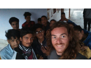
Theri Dam Reservoir
Big hike today, 1000m under a scorching sun to reach a South-West ridge where I think I can take off. With my heavy bag I'm slow, I reach the place around 2pm, the valley wind is quite present but the orientation is correct, the ridge takes the valley wind and the trade wind directly.
I prepare the wing on a small flat part, but at the break off the ridge the wind is strong. When I see birds still go up with their wings half tucked I know I'm in for a wild ride.
So I only take the center A lines, and gently pull. At first the wing is lazy, then it shoots forward like crazy when it takes the wind, and I'm catapulted into the air as I stop it over my head and untwist at the same time. The yearly Dune trainings with my club certainly pay off!
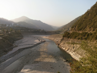
The flight is short and uneventful, I manage to exit the valley system and cross towards the long ridge I want to follow, but as before lack of thermals means I'm too low and have to land in the river bed.
This is usually filled with water to feed a dam 20km to the South, but they emptied it recently to remove all the sand accumulated at the bottom. I cross on a bridge so rusty it looks like it has been underwater for a while, but for my own peace of mind I prefer to not ask and ignore the issue.
Next, I need to find a room, take a good shower and analyze the next steps with Google Earth: find a takeoff, and think of my options to progress.
21 March 2017
Hawa
This is Hindi for "wind". This is also what defines my flying conditions since the start.
March 20.
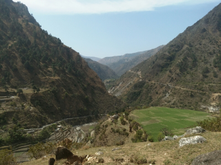
I still don't understand this place. Cold at night, hot during the day. Very strong valley winds that allow me to slowly progress, albeit with difficulty. But not a sign of a single thermal, not even in the very high mountains to the North. I don't know what fuels the valley winds is not for thermal activity. This is puzzling.
Today the flight was very unpleasant. The day started late, as I was waiting for the valley wind to pick up and ease my take off from the steep ridge. The whole village was here to admire the crazy Frenchie fly off.
Then started 3h30 of struggle in the wind, hopping from ridge to ridge to try and escape from a crazy, neverending valley system, where I was always in the lee of something.
I finally managed to top out and slowly progress, bit without thermal activity this means that I didn't have enough altitude to cross to the next valley system to the South East, and a very strong valley wind blocked me and forced me to land at the bottom, in the river bed.
Tomorrow I'll have to hike 1000m up the mountain to position myself at the top of the ridge, and hopefully take off and escape by the top.
21 March 2017
Hospitality
March 19. Big flight from Prashar lake to Kalich, a small ridge 100km to the South East, at the border between Himachal Pradesh and Uttarakand.
Today begins with a 2 hours hike, to escape from the forest guard who does not allow me to fly from here. The day starts very late so this does not delay my flight, but when landing so high I was counting on a 10 minutes hike instead...
The day starts as usual with no thermal and a lot of ridge soaring. The higher mountains to the South start to generate some nice cumulus, when I finally reach them a full street waits for me! At last, I can fly the sky and not the terrain. Very strong North-west trade wind pushes me in the right direction, it's quite easy to cover the distance today, but the conditions are still demanding and I'm happy to land on a ridge at 2300m after almost 4 hours of flight.
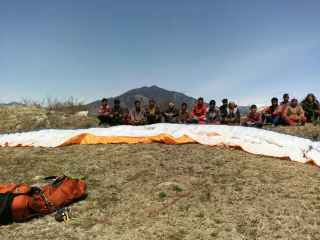
I land by a nice, big new house in a very small village. The owner, Sunil, is happy to invite me to stay, and I experience the warm indian hospitality. Visit of his apple orchard, then we go to a nice guest room where we will spend the evening, visited by his whole extended family (but only the males. The women are in the kitchen preparing our dinner). His big brother tried to trap me with his "local wine" but I manage to get out after one glass.
We dine with Sunil in my room while other people watch, they will eat later. This is a sign of respect for the guest, but it is difficult to adjust to!
Tomorrow I'll try to take off from a very steep part of the ridge, the only place without trees or lines. Hopefully the South valley wind will pick up early, the day seems good.
19 March 2017
Prashar lake
March 18. No thermals today, probably due to the large amount of humidity stored in the ground since the last couple of days. The hail storms of the past several days didn't help.
I take off at 11 even though it's blue, but I see some birds slowly climb above the Billing ridge. My wing is clearly overloaded, so in weak conditions it's a challenge.
It's very hard to get out of the bowl, I have to soar and find the ridges that are correctly oriented and take the wind. I'm progressing slowly, prudently, at first on a ridge just above the big valley. But when this proves a dead end, I have to go into deeper valleys, a maze of ridge where the wind is like in a whirlpool, and I'm never in a good place. Finally I manage to soar to Prashar lake where I land, some 3 hours and 40k from Bir.
Prashar lake is nice, a temple dedicated to a hermit who meditated here some time ago makes for a prime tourist destination. The lake has a natural floating island, and the view of the Himalaya is stunning.
Another cold night at 2600m, but everything is dry so it's manageable. I had to pay the forest guard so that he does not bother me too much about my lack of camping permit... Also he told me to leave in the morning with a bus, that paragliding is "closed" in the region, and that he'll call the police if I try to fly. We'll see!
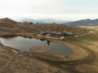
17 March 2017
Climate change
After a failed attempt on the 15th from the somewhat low ridge of Tahu, I hiked on the 16th to try to take off from magic view, 800m higher but at the far end of the Dharamsala Valley, eyeing a 2 hours window of less bad weather. Alas, the weather never improved during my hike, only getting worse by the minute. So, as I hoped the next day would be better, I hiked even higher on a better exposed ridge. The only small issue is that I had to hike up and down 500m through very difficult terrain, of course in a snowstorm because the weather God thought "hey, why not?"
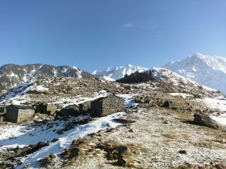
This is the view that graced my eyes this morning, after a very cold and damp night in the one hut that's not completely falling apart. I stumbled on these huts, emerging from the fog only 50m from my trail, not appearing on the map. I thought I was lucky, but after the sleepless night I'm not so sure! The hut was wet, it was impossible to light a fire inside. Lack of mortar between the rocks forming the walls means that the chilling wind is very present even inside, I think worse than a tent in similar conditions! At least I was able to use my small stove to cook (well, it's a bit of a grandiose word for warmish semolina. More on that later).
A couple of hours for my sleeping bag (and everything that was wet or damp) to dry in the morning sun, and I took off from a small platform on the right of the picture (a bit like the North face of Grand Colon for the Grenoblois, but smaller and stepper and with more rocks :-)
Committing but ok.
So today I finally managed to escape from Dharamsala! After 1 hour of classic mountain flight for the region (thermal, ridge, thermal, ridge, etc) I was forced by very very dark cloud to take a more southern line one small hills, under a nice cloud street. When this street finally joined the big mountains clouds where a storm was slowly brewing, mostly behind me but also in the front, I decided that it was too dangerous to continue fly and landed in Bir. Tandems were still flying and landing for half an hour after my landing, but we could hear the storm closing in, and wind gusts started to be stronger! They are crazy. A small hour after I landed we had a hail storm that lasted the whole afternoon...
The locals told me it's an insane weather for the season, usually they wear t-shirts now. As this is what I've found during my research, I'm not equipped to stay high in the mountains with winter conditions like that. Oh well. I'll have to revise my plan and stay low, a bit more to the South... I have maybe two or three flyable days before another storm comes in, we'll see!
15 March 2017
Same same but different
Early morning the day seemed promising from the sunny terrasse: clear blue sky, birds circling from 9:30 over the city. But by the time I arrived at take off, the whole sky was this whitish gray that we all fear, the sun barely noticeable over the thick cirrus cover.
After waiting for THE cycle of the day, and trying to scratch my way up, it became clear that today's outcome would be no different than yesterday: sled ride just above the treetops and power lines, and then long walk back up.
But I have a different plan for tomorrow. If we are to trust the forecast, I have a window in the morning. So I'm sleeping higher and closer to the mountains, and in the morning a nice hike will bring me to Magic View, where apparently I should be able to take off earlier, and more importantly higher. We'll see!
14 March 2017
Go
Last complete breakfast before long, enjoying the slowly warming morning sun on the terrasse of a small restaurant. The sky looks inviting.
Mountains are calling. Let's go!
13 March 2017
Dharamsala
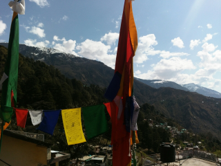
It is a sight to be seen. A maze of houses perched on top of a ridge, close to the snow line. Narrow streets buzzing with Punjabis on holidays and Buddhist monks on a pilgrimage to listen to the Dalaï Lama. 3 wheelers rikshaws wheezing by, dangerously close to you and the endless row of stalls lining Temple Street, honks barely covering the merchants. Prayer flags everywhere.
On this cloudless, full moon evening, I can only wonder about today's marvels. The endless queue of monks and Tibetans, early morning, to receive the coveted pass to enter the inner Temple. The courtyard and Temple filled with thousands of freezing people, listening to His Holiness teaching in Tibetan language, foreigners listening to live translations on cheap radio sets. The shared masala tea prepared by the local monks. The silent devotion of everybody when the Dalaï Lama left the temple, only calm moment of the day, before sharing a big bowl of Dahl Bat with their family in the now sunny courtyard.
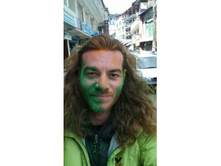
Then, the explosion of colors when you exit the temple and cross way with overjoyous Punjabis, holding what seems to be endless reserves of pigments. Holi Mubarak! The fact hat I don't have hot water in my cheap Lodge is lost in the brawl :)
Contrasts. After experiencing in one day two of the most important events for Tibetans and Indians, in what seems to be two different world, here in McLeod Ganj, I can't help but think that is the perfect start to my humble journey, lost in the Himalaya.
08 March 2017
Gear
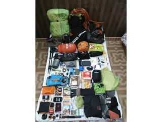
I've spent some time weighting and carefully preparing my gear for the vol-biv trip.
I end up with a 21.6kg bag, without water, which is okay considering I have a tent, mattress, big sleeping bag and all I need to fly and survive in the mountains.
The weight is dispatched as follow:
- Flying equipment: 10.3kg
- Survival kit: 900g
- Hiking: 1.5kg
- Bivouac: 4.1kg
- Food: 2.5kg (without water)
- Clothes on me: 2.5kg
- Change of clothes: 700g
- Electronics: 1.8kg
- Toilettries: 700g
- Papers: 300g
- First aid kit: 245g
- Bags: 70g
Full list
Needless to say, I hope to fly most of the way! :)
10 February 2017
WingShop
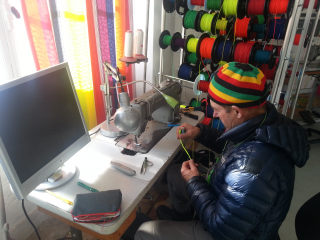
Today I've spent an hour at
WingShop in Saint Hilaire with my friend Phiphi.
He controls my wings every year, and today he taught me how to measure lines, do épissures and other small things.
Thanks to him I have a full sewing kit, with enough spare lines and ripstop to open my own shop :D
Now I can repair my wing in the middle of the mountains!


